Product Description
Functional Integration for Industrial Operators
The LH-MJY3200 UAV is engineered specifically for enterprise and professional drone users requiring reliable vertical take-off and landing performance combined with payload flexibility. As a product targeted by leading drone manufacturers, it caters to complex aerial operations where automation and precision are priorities. Its 25kg maximum take-off weight allows integration into workflows involving inspection, surveying, and delivery, positioning it as an essential drone for companies demanding high operational efficiency and minimal manual handling in diverse environments.
Advanced Technical Specifications Ensure Operational Efficiency
This drone manufacturer’s flagship drone features a composite hybrid design merging fixed-wing endurance with multi-rotor versatility, enabling efficient 210-minute flight endurance without load and 90 minutes carrying a 4.5kg payload. The advanced GNSS system incorporates GPS, GLONASS, Galileo, and BDS satellite constellations for precise navigation and waypoint accuracy within 20cm landing offset. Its IP54 rated platform and IP45 airframe ensure robust performance across temperatures from -20℃ to 60℃. Maximum cruising speeds reach 90km/h with bursts over 120km/h, supporting long-range missions up to 270km with customizable control radius exceeding 15km.
Applicable Across Multiple Industrial Fields
The LH-MJY3200 UAV serves a variety of sectors requiring high-precision aerial data acquisition and autonomous flight operations. Within infrastructure inspection, agriculture, and environmental monitoring, this professional drone offers a scalable solution optimizing mission turnaround with rapid assembly and payload adaptability. Its capabilities deliver operational value through integration with mission-specific sensors, supporting workflows like photogrammetry, precision agriculture, and disaster response. drone manufacturers highlight this model for industrial drone users who demand consistent reliability and flight stability for critical applications
Product Advantages
Innovative Design with Modular and Autonomous Systems
The design of this drone model prioritizes modular construction and rapid assembly, allowing disassembly within five minutes to facilitate transport and deployment. Constructed of carbon fiber and aviation-grade composites, the architecture balances lightweight properties with mechanical strength, critical for drones available for procurement in professional markets. It integrates smart autonomous control platforms with dual airborne GPS and a quick-release photoelectric pod compatible with various sensor modules. This system design reflects a high level of engineering sophistication favored by drone manufacturers targeting applications requiring vertical take-off with minimal operator intervention.
Optimized Flight Performance Enhancing User Productivity
Performance metrics emphasize endurance, speed, and stability, making this drone a valuable asset in professional drone deployments. Its long sailing time and 5kg mission payload accommodate diverse equipment configurations while maintaining reliability under harsh weather conditions. The autonomous vertical take-off and landing feature reduce ground crew requirements, enhancing operational efficiency. Users benefit from the integrated Android-based ground control station featuring a 7-inch HD screen with over six hours of battery life, streamlining mission control and data gathering, thereby increasing overall return on investment for drone manufacturers and industrial drone operators.
Use Scenarios
Extended Range Survey Operations in Remote Areas
In environmental monitoring and large-scale land surveys, the LH-MJY3200 UAV offers crucial advantages to professional drone users by supporting extended flight duration and a high level of autonomous operation. The drone’s vertical take-off capability eliminates runway dependency, enabling deployment in rugged or inaccessible locations typical of remote survey areas. Its compatibility with multiple GNSS constellations and ruggedized design assures consistent performance despite challenging climates. Integrated with geospatial data systems, this drone serves as an efficient aerial platform that enhances operational workflow while maintaining compliance with aerial safety regulations embraced by drone manufacturers.
Precision Infrastructure Inspection with Rapid Deployment
Infrastructure sectors requiring detailed inspections of bridges, power lines, and telecom facilities benefit from the flexibility and precision of this product from a drone manufacturer. The LH-MJY3200’s quick assembly system allows rapid mobilization onsite and the vertical take-off function negates the need for fixed launch zones. Its payload capacity supports multispectral and photogrammetric sensors that deliver high-quality data for maintenance assessments and asset health monitoring. This professional drone seamlessly integrates into existing inspection workflows, improving data turnaround times and safety metrics, thus providing demonstrable operational gains within critical infrastructure environments.
Technical index
| Technical index of LH-MJY3200-039 vertical fixed-wing airframe |
| Dimensions |
Wingspan 3.2m, length 2m |
| Body weight |
5.2kg |
| Maximum take-off weight |
25kg |
| Recommended take-off weight |
20kg |
| Sailing time |
210min (no load), 90min (4.5kg load) |
| Recommended mount |
<6kg |
| Tail pusher motor/ESC |
AT5330/AT115A |
| Tail propeller |
19 inches |
| Rotor motor/ESC |
6 series/60A |
| Rotor propeller |
22 inches |
| Battery |
12 pieces of 6S 33Ah |
| Takeoff altitude |
> 5000 meters (high prototype) |
| Protection level/ rainproof |
IP45/light rain |
| Environmentally adaptive |
Meet the relevant environmental requirements in GJB150A-2009 |
| LH-MJY3200-039 body size parameters |
| Symmetrical motor wheelbase |
3200mm |
| Inner diameter of motor base |
72mm in diameter |
| Battery compartment size |
400x150x140mm(Length x width x height) |
| Equipment warehouse size |
350x150x120mm(Length x width x height) |
| Landing gear height |
294mm |
Flying platform
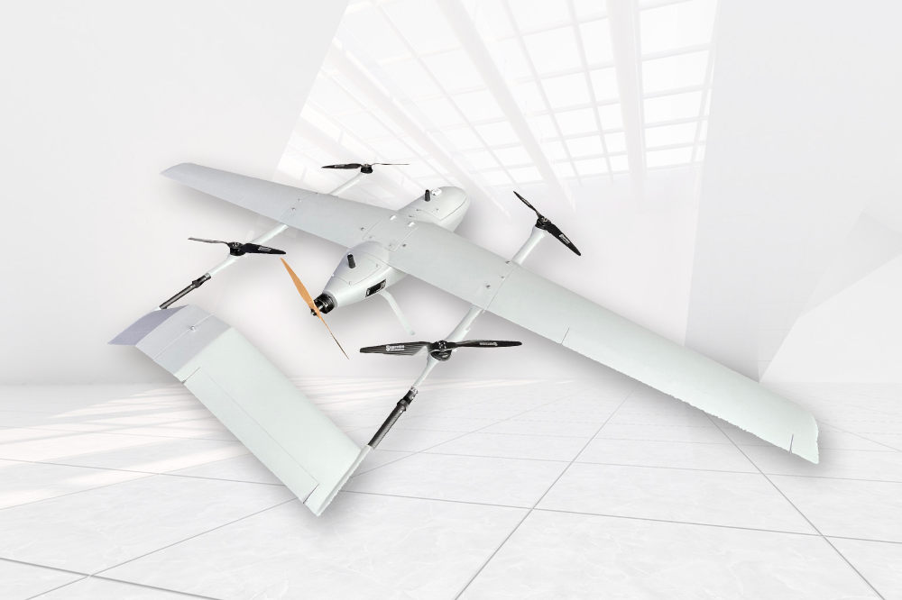 |
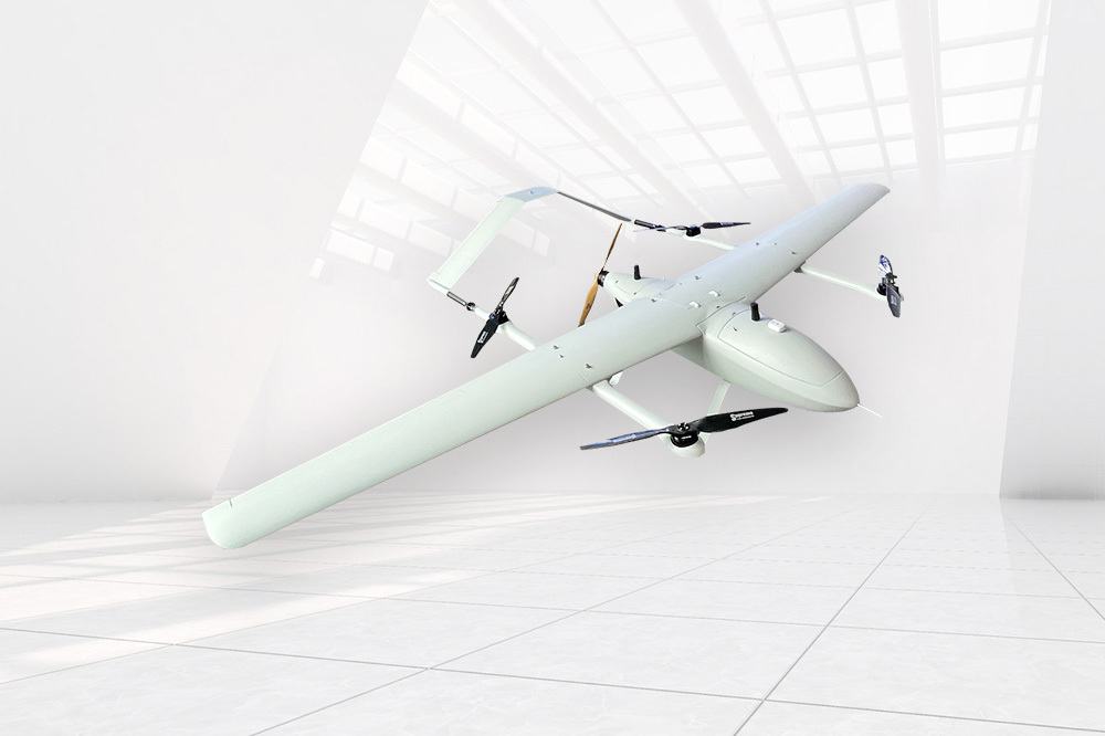
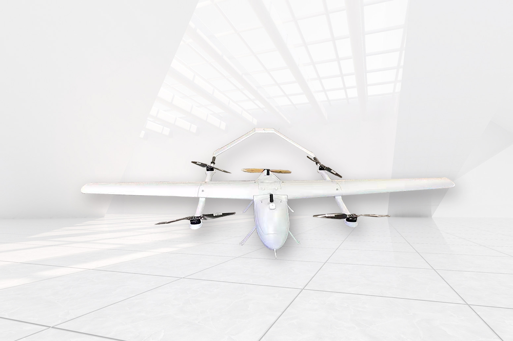
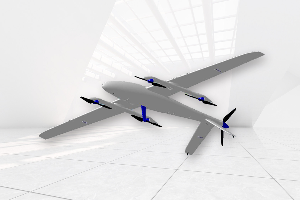
- Model: A composite wing layout combining fixed wing and multi-rotor;
- Body material: carbon fiber + aviation composite material
- Power system: Lithium battery power system
- The wingspan is 3.2m long and the fuselage is 1.75m long;
- The maximum total take-off weight is 25g, and the maximum mission load is 5kg;
- No manual intervention is required for vertical take-off and landing, and the offset of the landing point is ≤20cm;
- Life time 3.5h;
- Maximum range 270km
- Cruising speed 90km/h, maximum level flight speed ≥120km/h;
- Wind resistance ≥7;
- Take-off altitude ≥3500m, level flight altitude ≥6000m;
- Maximum control radius 15km
- Sea level climb speed 4m/s
- Dustproof and waterproof level: IP54
- Working temperature -20℃-60℃
- Modular design, with fast assembly and disassembly functions, the assembly and disassembly time is less than 5 minutes;
- The pitot tube has the function of low-temperature automatic heating and drainage, which can prevent the pitot tube from freezing in complex environments such as high altitude, low temperature and high humidity;
- In the level flight mode, the quad-rotor propeller has a locking function, so that the quad-rotor propeller keeps feathering and leveling, reducing aerodynamic drag;
- The flight platform has the function of airborne dual GPS to measure the heading angle;
- There is a photoelectric pod quick release mechanism in the mission cabin of the flight platform. Facilitate quick disassembly of the pod before and after the mission;
- Night navigation capability: with navigation indicator;
- Flight attitude stability: pitch angle stability ≤ 4°, roll angle stability ≤ 5°, yaw angle stability ≤ 3°;
- The image transmission scheme adopts an integrated scheme of image and data, with a frequency of 2.4 GHz and a control distance of 15 kilometers (standard version, customizable);
- Flight control deviation: track deviation ≤0.5m, standard deviation ≤0.3m;
- Hovering control deviation: horizontal deviation≤0.3m, vertical deviation≤0.3m;
- Carrying ability: It has the ability to carry dual-light photoelectric pod, image transmission, and orthophoto camera at the same time;
- Extensibility: It can be replaced with other sensors such as lidar.
|
Flight control and navigation system
- Support the whole process and fully autonomous flight;
- Differential GNSS system supports GPS, GLONASS, Galileo, BDS four-star and eight-frequency signals;
- With the monitoring function of the ground station, the operation status of the drone can be monitored in real time at the ground station;
- Emergency response capability: has the function of near-ground avoidance;
- Temperature compensation, all sensors can perform temperature compensation in the range of -20 degrees to 70 degrees;
- Sensor integration, with 3-axis accelerometer, 3-axis angular velocity meter, magnetic sensor, dynamic and static pressure sensor;
- The black box can store 4 hours of detailed flight data at a frequency of 50 Hz;
- Waypoints, ≥800;
- Update frequency, ≥200Hz;
|
 |
Broadband link
 |
- Configure dual telemetry and remote control links, one of which is disconnected and can be switched to the other link;
- The working frequency band meets the relevant requirements of the Ministry of Industry and Information Technology on drone-piloted aircraft systems;
- Maximum bit rate ≥8Mbps;
- Transmission video resolution ≥1080P 50fps;
- Full end-to-end delay of video boundary ≤200ms;
- Operating distance ≥15km (customizable);
- RF power ≤2W;
|
The ground command station is a handheld ground operation terminal, integrated with a 7-inch high-definition high-brightness screen, the screen resolution is ≥1080P, and the total weight is 1kg;
- Operating system: Android;
- Digital image transmission and remote control: data link, remote control link, and video link are integrated;
- Built-in battery working time ≥6h, and with external backup battery access function;
- Support USB projection to computer or display screen;
- Control radius ≥15 kilometers (standard version, can be customized);
- Built-in GPS, built-in 4G module;
- Working temperature: -20℃~60℃;
- Support one aircraft dual control function, which can realize separate control of aircraft and mount;
- Pod angle control, zoom, infrared mode, screen switching, image tracking, infrared correction, OSD display, brightness adjustment, contrast adjustment, landing instructions and other functional physical buttons;
- Support standard pre-flight inspection, and cannot take off if the self-inspection fails;
- Support multiple mission modes such as area scan, path scan, fixed-point gaze, etc., automatically plan and execute the flight plan, improve mission efficiency;
- Comprehensive display of system status and mission status, including: attitude, speed, altitude, position, route status, battery status, link status, photoelectric pod status and other information, image data (infrared images include heat map data) can be stored and exported, Flight log data is complete, can be stored and exported;
- Support custom video OSD display information content and language;
- Support route preview function, which can visually display route altitude and terrain altitude difference to avoid mountain collision accidents;
- Support automatic emergency landing, in case of failure and unable to return to the preset landing point, the closest preset emergency landing point will be automatically selected for forced landing to ensure safety;
- Support real-time video output, and input the video of the photoelectric pod to the back-end equipment through the network port;
|
 |
FAQ
What materials are used in the construction of the LH-MJY3200 UAV?
Our professional drone features a durable build made from carbon fiber and aviation composites, ensuring lightweight strength and reliability. This material choice supports rapid assembly while maintaining excellent flight stability, crucial for industrial drones designed for demanding environments.
Can I customize the maximum control radius and payload options for this drone?
We offer customization for the LH-MJY3200 UAV's maximum control radius, which can be adjusted beyond the standard ≥15 km to fit your mission needs. Additionally, with a 5kg maximum payload capacity, our drone manufacturer team can assist in tailoring payload setups for specific industrial applications.
How does the modular design affect deployment and maintenance?
The modular design enables assembly and disassembly in under five minutes, allowing for quick deployment and transport. This feature simplifies maintenance and reduces downtime, which is essential for business operations requiring dependable drones available for procurement with streamlined servicing.
What are the typical applications supported by the LH-MJY3200 UAV?
Our LH-MJY3200 UAV is suitable for aerial surveys, infrastructure inspections, environmental monitoring, disaster response, and precision agriculture. Its VTOL design with long endurance meets the high standards industrial buyers expect from a leading drone manufacturer in efficiency and adaptability.


